1: 0,00 km / 1420 m: Start Serfaus church towards the exit of the village until parking area finish2. 0,78 km / 1425 m: parking area finish easily downhill on the right - following the direction board Finesweg to Fiss, before the Fineshof follow easily on the left side the hiking and bike trail (across the meadows) until the T-junction Serfauser Feldstrasse3: 1,78 km / 1404 m: Serfauser Feldstrasse easily uphill on the left - across the direction board Fiss - following the bike trail to Fiss4: 3,00 km / 1422 m: Fiss - past Hotel Fisserhof the second left turn easily uphill until the town hall, Raiffeisenkasse5: 3,28 km / 1410 m: post office, town hall - abrupt uphill on the left, continuing past the sawmill6: 4,28 km / 1520 m: asphalt finish, gravel path begin, past the gates, without to turn, continuing until Rabuschl, follow the direction board Schöngampalm7: 6,50 km / 1600 m: Rabuschl (children’s playground, water fountain), continuing straight ahead easy uphill, follow way nr. 4 Schöngampalm, without to turn until Schöngampalm8: 17,50 km / 1878 m: Schöngampalm (snack-bar), from here the same trail back until Serfaus9: 35,00 km / 1427 m: finish Serfaus
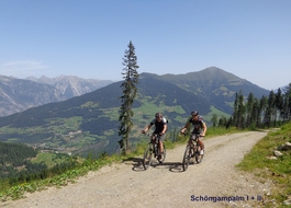
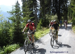
9 Schöngampalm Tour I
Tour data:
- Distance: 30.3 km
- Ascent: 656 m a.s.l.
- Difficulty: easy
Description
Waypoints on this tour:
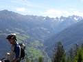
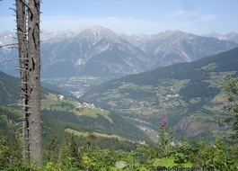
Observation point | After 6.9 km
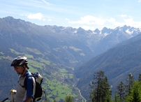
Observation point | After 6.9 km
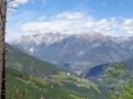
Observation point | After 10.9 km
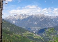
Observation point | After 10.9 km
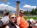
Snack-bar | After 14.9 km
Snack-bar | After 14.9 km