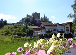
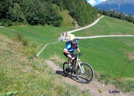
1: 0,00 km / 1420 m: Start Serfaus church towards the exit of the village until parking area finish2. 0,78 km / 1425 m: parking area finish easily downhill on the right - following the direction board Finesweg to Fiss, before the Fineshof follow easily on the left side the hiking and bike trail (across the meadows) until the T-junction Serfauser Feld Strasse3: 1,78 km / 1404 m: Serfauser Feldstrasse easily uphill on the left - across the direction board Fiss - following the bike trail to Fiss4: 3,00 km / 1422 m: Fiss - past Hotel Fisserhof the second left turn easily uphill until the town hall, Raiffeisenkasse5: 3,33 km / 1438 m: Raiffeisenkasse, town hall easily right direction board Kulturhaus, follow Untergasse until on the brink of the Kulturhaus - bifurcation6: 3,57 km / 1442 m: bifurcation on the right, easily downhill past the Kulturhaus, past Kulturhaus Fiss follow the direction board Ladis meadow path nr. 27: 3,90 km / 1429 m: bifurcation on the left, continuing flat, follow direction board Ladis meadow path nr. 2 until asphalt finish8: 4,75 km / 1408 m: bifurcation, asphalt finish, easily uphill on the left, direction board Falterjöchl, follow Rabuschl nr. 2b9: 5,17 km / 1415 m: past hay barn (wooden huts) on the right, behind the hay barn uphill on the left, single trail begin (short abrupt maybe 60m to wheel)10: 5,32 km / 1416 m: single trail finish, crossroads, at the turn uphill on the left, follow the direction board Falterjöchl - Fiss - Rabuschl nr. 3311: 5,95 km / 1477 m: flat crossroads on the right, continue following the direction board Falterjöchl nr. 312: 6,37 km / 1490 m: Falterjöchl (viewing platform on the hill) - continue downhill until the next junction13: 6,78 km / 1460 m: crossroads - uphill on the left, follow the direction board Schönegg nr. 3414: 7,45 km / 1497 m: crossroads straight ahead, follow the direction board Schönegg nr. 3415: 8,16 km / 1544 m: Schönegg (viewpoint - beautiful corner, a super view to Ladis), after 60m crossroads Schönegg downhill on the right, follow the direction board Ladis-Forstweg-Strasse nr. 6 until Forstweg finish - T-junction to asphalt path16: 10,36 km / 1359 m: Forstweg finish, asphalt begin, abrupt downhill on the left, follow the direction board Ladis nr. 1 (attention: asphalt road - traffic)17: 11,02 km / 1322 m: crossroads abrupt downhill on the right, continuing asphalt path, direction board Ladis nr. 1 until the castle pond Ladis18: 12,50 km / 1203 m: castle pond Ladis (idyllic) continuing on the right, past the well (drinkable water), past the church, easy uphill along the village street until the station at the bottom Sonnenbahn (alternative: to bike the road until Serfaus - 200hm + 7km)19: 13,33 km / 1244 m: station at the bottom Sonnenbahn - uphill with the funicular (middle station Sonnenburg don’t get out) until Fiss Village20: 13,33 km / 1473 m: Fiss village Sonnenbahn downhill on the right, continuing until the road to Serfaus, direction board Ausfahrt, back on the hiking and bike trail to Serfaus21: 16,92 km / 1420 m: Finish Serfaus
6 Family and pleasure Tour Ladis
Tour data:
- Distance: 19.8 km
- Ascent: 509 m a.s.l.
- Difficulty: easy