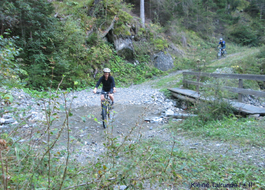
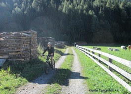
0: 0,00 km / 1427 m: Start Serfaus church towards funicular, past the Hotel Post until Restaurant Alt Serfaus1: 0,65 km / 1427 m: Restaurant Alt Serfaus down on the left, over the Mühlbrücke, continuing on the left2: 1,38 km / 1415 m: chapel St. Zeno stay on the left, continuing downhill towards St. Georgen Stadlwies3: 4,40 km / 1200 m: bifurcation St. Georgen Tschupbach, turn to the right, continuing downhill towards Tschupbach4: 6,43 km / 935 m: Tschupbach, gravel path finish, asphalt begin, turn to the left towards Tösens5: 6,73 km / 935 m: on the right over the bridge, following this street until Tösens6: 7,25 km / 931 m: entry of the village Tösens, straight ahead through the place, past the church without to turn, after the main through-road stay on the right, asphalt7: 9,12 km / 930 m: Through the subway of the main road, continuing on the old land road, without to turn from Tösens to Ried8: 12,68 km / 877 m: entry place-name sign of Ried, straight ahead through Ried to the village church, crossroads9: 13,60 km / 877 m: crossroads village church - Elektro Patscheider turn to the left, continuing straight ahead until the Innbrücke10: 14,01 km / 877 m: over the Innbrücke, immediately after the bridge you have to turn to the right, continuing between Inn and farmhouse, asphalt11: 14,12 km / 875 m: asphalt finish, gravel path begin, continuing along the Inn12: 14,23 km / 873 m: bifurcation, stay on the right side13: 16,20 km / 870 m: pasture fence - close the fence14: 16,70 km / 868 m: gravel path finish, asphalt begin, continuing until the Eisenbrücke15: 16,78 km / 868 m: directly before the Eisenbrücke in Prutz you have to turn sharp on the left, uphill to the Cafe Felsenburg16: 16,97 km / 900 m: by the Cafe Felsenburg you have to turn sharp on the left, continuing uphill17: 17,06 km / 910 m: asphalt finish, continuing uphill along the forest road18: 18,04 km / 975 m: forest road finish, T-junction to the street towards Ladis, continuing uphill on the right, asphalt until the village Ladis19: 19,30 km / 1150 m: village entry of Ladis, continuing following the street20: 19,90 km / 1200 m: uphill on the left by the Hotel Bad Ladis, continuing towards Serfaus Fiss, past the church until the town hall21: 20,00 km / 1205 m: immediately after the town hall uphill on the right 10 m then uphill on the left direction board Fiss way nr. 1222: 20,24 km / 1220 m: bifurcation, stay on the right side, continuing uphill23: 21,32 km / 1285 m: asphalt finish, meadow path begin, bifurcation downhill on the left, meadow path to Fiss24: 22,22 km / 1350 m: meadow path finish, asphalt begin, continuing straight ahead to Fiss25: 23,25 km / 1436 m: entry to Fiss, past the chapel Josef, straight ahead without to turn cross Fiss, to the post office, past the town hall, easy downhill on the right to the bypass to Serfaus26: 23,90 km / 1430 m: crossroads bypass, by the Hotel Fisserhof you have to turn to the right to Serfaus27: 27,36 km / 1427 m: finish Serfaus
23 Small valley circuit
Tour data:
- Distance: 25.8 km
- Ascent: 610 m a.s.l.
- Difficulty: average
Description
Waypoints on this tour:
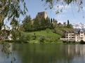
Seeing | After 19.7 km
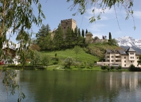
Seeing | After 19.7 km
Historic building | After 23.4 km
Historic building | After 23.4 km