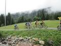
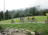
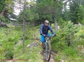
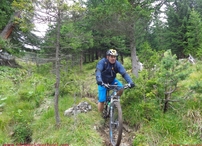
0: 0,00 km / 1420 m: Start church, uphill past the town hall / post office, asphalt1: 0,50 km / 1470 m: bifurcation, before the Hotel Bär uphill on the left, after 40 m turn right, continuing uphill way Nr. 4, asphalt2: 1,63 km / 1575 m: asphalt finish, uphill on the left without to turn until the water basin and there past it on the left side, continuing gravel path3: 3,33 km / 1645 m: bifurcation, sharp uphill on the right, following direction board Kölnerhaus way Nr. 9, next bifurcation continuing straight ahead until the Kölnerhaus4: 5,26 km / 1855 m: past the Gampenbahn, following the gravel path until the Kölnerhaus5: 5,80 km / 1955 m: bifurcation uphill on the right, following the gravel path, next bifurcation continuing straight ahead6: 6,15 km / 1965 m: bifurcation (200 m before the Kölnerhaus) continuing on the left, gravel path overgrown with grass, following direction board Observatorium/Rodelhütte way Nr. 12a7: 6,35 km / 1970 m: pasture fence, single trail begin, following way Nr. 12a8: 6,73 km / 1965 m: bifurcation downhill on the right, single trail, following direction board Observatorium/Rodelhütte way Nr. 12a (carrots and steps)9: 7,29 km / 1895 m: single trail finish - gravel path begin, downhill on the left, following direction board Observatorium/Rodelhütte way Nr. 12a10: 7,92 km / 1873 m: bifurcation continuing straight ahead, past the Rodelhütte11: 8,11 km / 1830 m: bifurcation downhill on the right, following direction board Madatschen/Serfaus way Nr. 12a12: 8,81 km / 1815 m: bifurcation downhill on the right, following direction board Rieserweg to Serfaus way Nr. 513: 9,24 km / 1765 m: broad gravel path finish - single trail begin, downhill on the right, following the yellow direction board Rieserweg to Serfaus way Nr. 5 (at the beginning short wheel parts)14: 10,44 km / 1570 m: single trail finish - gravel path begin, downhill on the left, following direction board Serfaus, St. Georgen, Tschppbach Tösens15: 12,80 km / 1320 m: gravel path finish, bifurcation uphill on the left, following direction board to Madatschen/Serfaus way Nr. 516: 15,25 km / 1425 m: past the chapel St. Zeno, bifurcation continuing easily on the right until the Mühlbrücke, uphill on the right to the Restaurant Alt Serfaus17: 15,92 km / 1445 m: Restaurant Alt Serfaus, village road straight ahead until the Hotel Post18: 16,19 km / 1445 m: by the Hotel Post, towards the church19: 16,65 km / 1440 m: finish Serfaus
20 Komperdell Tour II
Tour data:
- Distance: 16.3 km
- Ascent: 729 m a.s.l.
- Difficulty: average
Description
Waypoints on this tour:
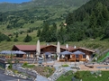
Restaurant | After 3.3 km
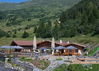
Restaurant | After 3.3 km
Others | After 4.1 km
Others | After 4.1 km
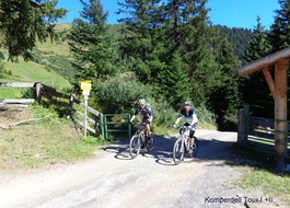
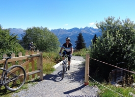
Trail | After 9.7 km
Trail | After 9.7 km