0: 0,00 km / 1410 m: Start Serfaus church towards village exit Serfaus1: 0,65 km / 1420 m: bikeway to Fiss2: 3,28 km / 1410 m: second village entry from Fiss after the Hotel Fisserhof, uphill on the left until the town hall, post office3: 3,55 km / 1420 m: town hall / post office, easily uphill on the left 5 m, then easily right, following direction board Kulturhaus4: 3,82 km / 1420 m: bifurcation above Kulturzentrum, continuing uphill on the left, past the Hotel Bergdick until the house Pittl5: 4,07 km / 1440 m: house Pittl - behind the house Pittl continuing easily on the right side way Nr. 3 Obladis, gravel path begin6: 5,54 km / 1460 m: bifurcation, continuing uphill on the left way Nr. 3 Obladis7: 5,99 km / 1450 m: Falterjöchl - downhill begin, continuing towards Obladis8: 6,40 km / 1400 m: crossroads, continuing downhill towards Café Obladis9: 7,16 km / 1350 m: bifurcation, continuing easily flat on the left direction board Café Obladis, Single trail10: 7,53 km / 1360 m: Café Obladis - behind the Café Obladis downhill on the right, direction board towards Ladis11: 7,61 km / 1360 m: bifurcation downhill on the right, continuing towards Ladis12: 7,69 km / 1360 m: sharp left curve downhill, gravel path finish, asphalt begin13: 8,02 km / 1340 m: bifurcation - uphill on the left way Nr. 6 Neuegg forest road begin14: 8,64 km / 1400 m: bifurcation Single trail begin, continuing downhill on the right Herrenweg Nr. 6 towards Neuegg15: 9,32 km / 1350 m: Single trail finish, following uphill on the left the asphalt street to Neuegg16: 9,72 km / 1370 m: Jausenstation Neuegg, continuing uphill on the left, asphalt finish and continuing gravel path17: 9,84 km / 1420 m: bifurcation easily uphill on the left towards Schöne Aussicht - viewing tower18: 10,41 km / 1475 m: bifurcation, continuing straight ahead yellow direction arrow Hochgallmigg19: 10,77 km / 1505 m: pasture fence and bifurcation, continue to drive on the left side, yellow direction arrow Hochgallmigg, downhill begin20: 12,79 km / 1430 m: Downhill finish, continuing easily uphill21: 13,81 km / 1515 m: bifurcation, right curve uphill yellow direction board Nr. 16 Hochgallmigg22: 14,01 km / 1520 m: bifurcation, turn sharp right, Single trail downhill, direction board Nr. 16 Hochgallmigg 8 m downhill then uphill on the left, path hardly visible until direction board Hochgallmigg, overgrown forest road until the river23: 14,25 km / 1500 m: small wooden bridge24: 14,32 km / 1500 m: begin broad forest road and downhill25: 14,64 km / 1460 m: bifurcation continuing downhill on the right26: 15,08 km / 1460 m: bifurcation continuing downhill on the right27: 15,36 km / 1440 m: bifurcation turn left continuing easily downhill way Nr. 10 Hochgallmigg28: 16,03 km / 1430 m: bifurcation continuing flat on the left29: 16,90 km / 1400 m: bifurcation driving downhill on the right30: 17,99 km / 1380 m: bifurcation continuing downhill on the right31: 18,44 km / 1340 m: asphalt begin, serpentines downhill until the church, Hochgallmigg32: 19,90 km / 1280 m: church, bifurcation, sharp right downhill way Nr. 13 Niedergallmigg by Gasthof Alpenrose, under the terrace continuing downhill the field road on the right33: 20,20 km / 1140 m: sharp and steep downhill on the left, direction board Niedergallmigg Nr. 13 after 6 m continuing on the right, Single Trail begin, attention: high stairs, ridable, until the river you have to wheel the bike ca. 300 m uphill34: 20,96 km / 1060 m: single trail finish, broad forest road begin, turn left - flat35: 21,53 km / 1140 m: bifurcation, continue to drive straight ahead36: 21,80 km / 1245 m: field road finish, asphalt begin, continuing downhill on the left towards Niedergallmigg Nr. 13, always along the street until to the Inn, beautiful downhill37: 25,75 km /
18 Hochgallmigg Tour
Tour data:
- Distance: 40.0 km
- Ascent: 1010 m a.s.l.
- Difficulty: average
Description
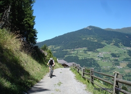
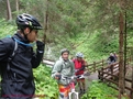
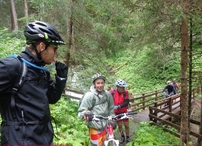
Waypoints on this tour:
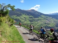
Observation point | After 17.6 km
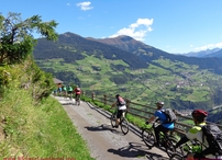
Observation point | After 17.6 km
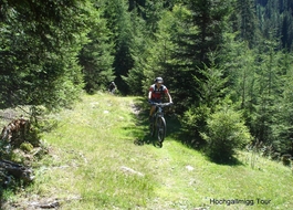
Trail | After 19.4 km
Trail | After 19.4 km